It’s been 15 years since my one and only contribution to the Confluence Project, an achievement I savour to this day. The goal of the online repository is ambitious, but seemingly simple: to store photos—and perhaps a little travel story—from the intersection of every integer degree of longitude and latitude in the world. So far, 6,594 of these confluences have been recorded, but there are still almost 10,000 to go, even discounting the oceans they don’t expect people to reach.
Nunavut, Canada’s Inuit territory, holds hundreds of confluences, but only a handful have been visited. On the evening of March 10, 2007, the week of polar sunrise, I happened to pass near the confluence of the 80th degree North latitude and the 86th degree West longitude. I was visiting the Eureka High Arctic Weather Station on Ellesmere Island in Nunavut, the northernmost civilian outpost in the world. Its military counterpart Alert is the northernmost continuously inhabited place, bar none, and that’s on the same island, just a few fjords further north.
My purpose at Eureka was to write a profile of the Polar Environmental Research Lab, which lay one mile North-West of this particular confluence. Polar sunrise is a particularly interesting time for atmospheric scientists, because they can get readings of the ozone layer after a whole winter of minimal interactions with sunlight, hence the timing of my visit. It also meant the temperature was -46 degrees Celsius.
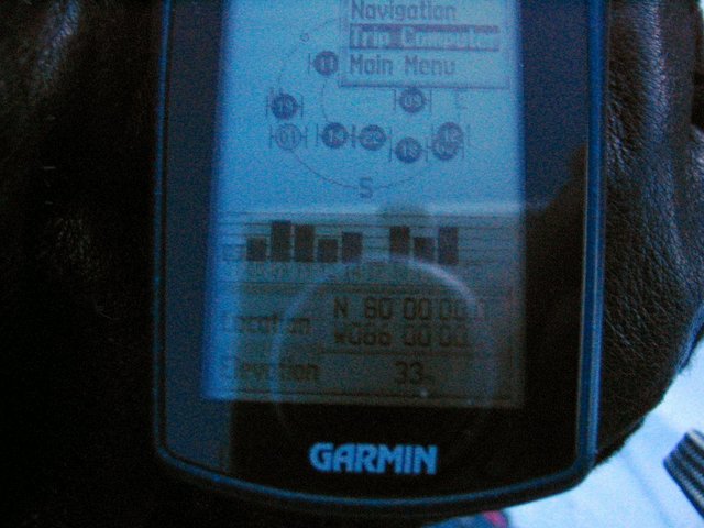
That evening, a group of research scientists, postdoctoral fellows and I tromped out through the scritching snow until we narrowed in on the coordinates. In addition to landscape photographs, the project instructions were to document the GPS reading at the confluence to verify our location. The trouble is, batteries don’t work very well at those temperatures, and the screen seemed to freeze in the cold, too, so one of the post docs had to hold the GPS inside her mittens to keep it warm, only whipping it out periodically to take a reading. Finally we got our even 80N 86W display:
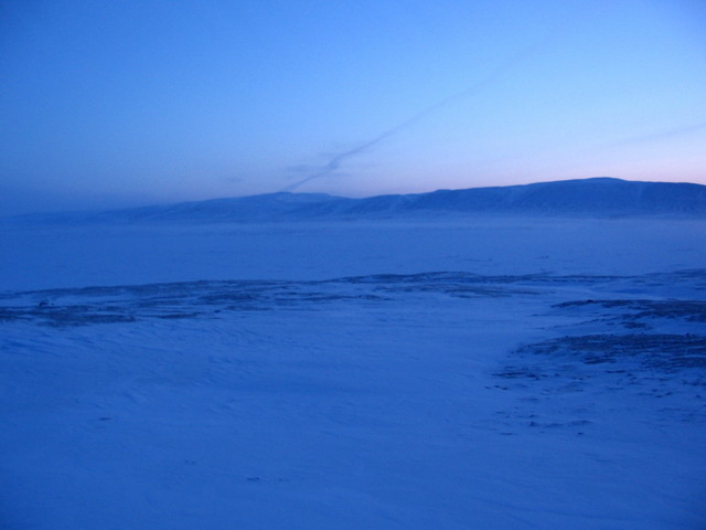
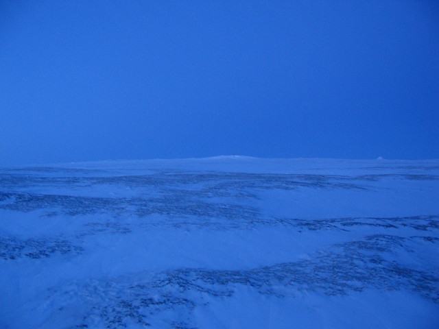
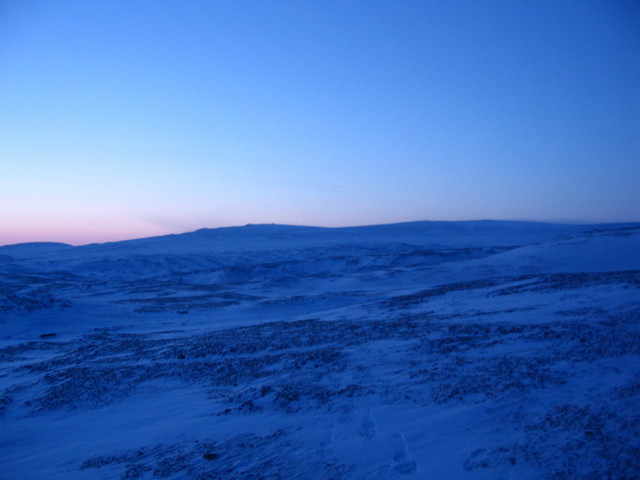
Now for the landscape photos. At the top of this post, you’ll see the view to the South. To the North, there was nothing but winter glow:
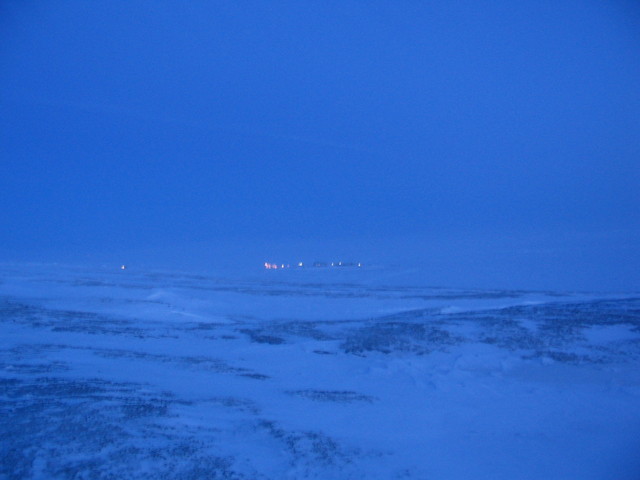
To the East, the little, cheerful lights of the weather station, whose landing strip had been lit by flaming kerosene pots when I arrived on the resupply plane:
And to the West, a delicate Arctic Circle sunset:
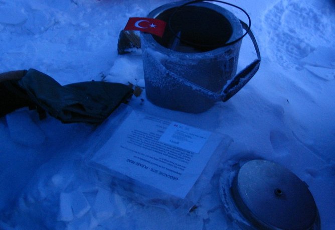
But the most unexpected pleasure came when we looked down—in this desolate place on the edge of habitability, some explorers who came before us had left a geocache on the exact confluence spot—a pot with a little collection of memorabilia inside. Our group added our own to the mix—a Turkish flag from one of the students, a business card and a sticker from the organization that ran the lab.
Now think of the most remote place you frequent. If you look it up, you may find a confluence waiting for you to stake your claim.
Fantastic! In 2019 I travelled on Ellesmere island with a friend. We hauled sleds for 6 weeks from Grise Fiord north to Makinson Inlet and back south to Grise via Bentham Fiord. We also found a not-yet-documented confluence point at 78N 83W. Upon our return south, we duly submitted our documentation but for some reason it was rejected. Not sure why. That confluence point does not appear in the list, either. Regardless, we stood at the intersection of those imagined lines where the views in all four compass directions were barely discernible from each other.
Very cool, and far more hard core than my brief trudge! I wonder how many of those ghost confluence posts are out there–a shadow project distributed on the computers of explorers.