I spend too much time on the computer. I’m doing it right now. Between files, tabs, and docs, I keep up Google Earth — when it doesn’t crash — catching by accident out of the corner of my cluttered desktop a bolt of a mesa or a canyon’s shadow. I click on it like taking a breath.
Looking in on a wild landscape must be good for the brain, a little flush of serotonin. Like Japanese forest bathing, only in the desert, and on a computer monitor showing overlaid images from private and governmental imaging organizations from around the world.
So, not forest bathing.
Time spent on screens appears to be associated with depression in adults. The intense light interrupts sleep patterns and, somewhere there’s got to be a study that shows this, it makes you into a worse person. Given all that, the best I can do when I’m supposed to be working is click Google Earth and tour around for a moment, like an angel in the sky. A 2015 study amongst 150 university students found that glancing at a monitor showing a roof top garden results in more accurate productivity than the same monitor showing a concrete roof.
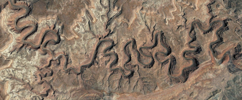
Yesterday, I dropped in on mostly local stuff, a 45-minute drive from my house, the torturous bends and goosenecks of the Dolores River as it flows across southern Colorado (pictured above). Zoom in, figure out what needs investigating.
I’ll look over and my girlfriend is ogling southeast Utah on her laptop (pictured below). She’ll have a piece of paper out, writing down directions.
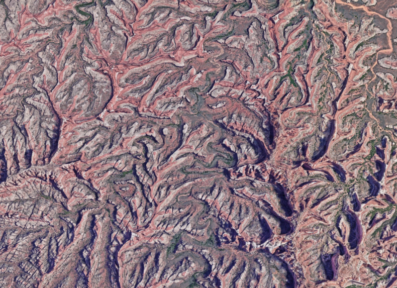
What the hell is this? she asks, tipping her laptop toward me. I recognize the pink and fleshy dendrites as the Needles District in Utah, from about half a mile above the ground. Horse Canyon, I tell her. She says, No, I said what the hell is this?
Cedar Mesa sandstone twisted by erosion into chapel spires, arches, and theater-headed canyons. It took her eye a moment to figure it out. If I hadn’t known the place, I would have thought it was something biological.
Sometimes I drift farther away, a desert I’ve traveled a few times in northern Mexico, Gran Desierto de Altar, the volcanic fields and sweeping dunes of the Pinacate. I can find where I’ve been, a water-cache camp set on the side of a small mountain range. I’ve used the range as a landmark on foot, making days-long forays into the dunes and back. The mountains are buried almost to their summits in a sand sheet, fawn-colored rock against the same-colored everything. From the air, it’s hard to tell the mountains are even there.
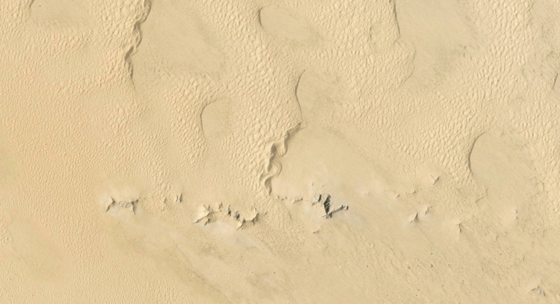
From the ground, the mountains look like tall ships sailing across a hurricane sea. They definitely are there.
The way we comprehend landscape and geography keeps unfolding, from travel at the speed of foot to horse to sail to essentially the speed of light. The ability to see our planet as a blue ball was only recent. Now I can spin it on my screen to my heart’s content. But I’m not looking through a space capsule window, not feeling the particular draw of gravity, space and time bending toward what I’m seeing. The air between me and the screen is a zombie buzz.
As an earth-bound creature sitting indoors, this might be the best you can get, clicking on the bigger picture, panning to whatever draws your eye, magnifying to look for dirt road access, squirting a little dopamine into the system. Which my girlfriend has been doing a lot lately in the Mojave Desert, southern California, tipping her screen, saying that we have five days and this is where she wants to go.
Whatever that is is on her screen, I agree.
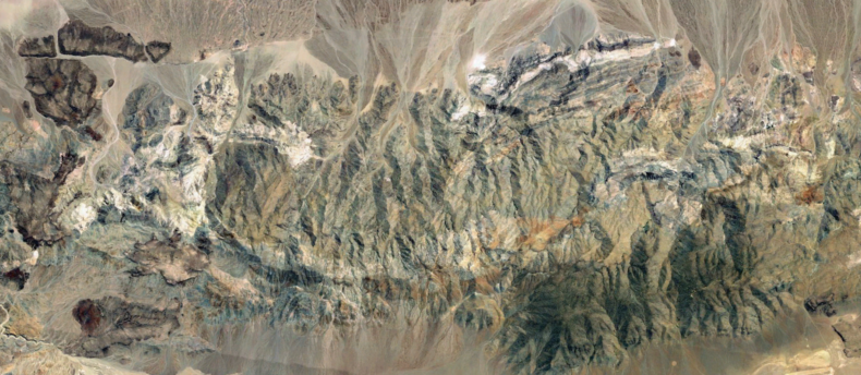
Photo snapshots from Google Earth.