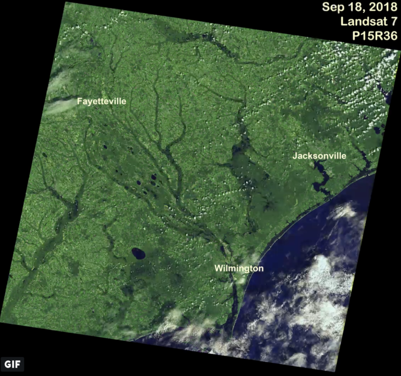
This is an image of a deluge, an absolute inundation, a drainage basin filled to the brim, a coast whose cup runneth over, total saturation, a scene that would make Noah cringe. This is, as my friend pointed out, a f*@kload of water.
This image shows how the land changed after Hurricane Florence was done, after the slow-moving storm finally spun out into meek wisps of white and the blue sky returned. It was made by a thinking box flying 440 miles above us. The box is called Landsat 8, and its job is to show us the terrestrial planet we live on, so we can understand it a little better. Its perspective is one that I think we could all kinda use right now. I don’t see any red or blue here, or BS on Twitter, ok? It’s just a picture of a chunk of this tragically beautiful planet that we have to share.
Here is what this imagery shows. According to an early estimate from the National Weather Service, nearly 8 trillion gallons of rain fell on North Carolina Sept. 13-17. That was a T. That’s an 8 with 12 zeroes after it.
We witnessed that unspeakable volume of water as catastrophic flooding — boats under oar floating through neighborhoods, whole interstates drowned, porches and pigpens submerged, homes and mementos washed away. Satellites witnessed it as a literal reshaping of the Earth’s crust.
#HurricaneFlorence is gone, but views from space show water inundation throughout the affected areas. #Landsat can prove invaluable for emergency response and disaster relief efforts. pic.twitter.com/mJdeZMIIH5
— USGS Landsat (@USGSLandsat) September 20, 2018
Landsat’s perspective gives us more than individual stories; it sees entire swollen rivers, inlets, channels and other water bodies whose particular taxonomy I can never keep straight. The whole landscape changed in this storm. Landsat’s buddies in space, the global positioning satellites, saw the Earth flatten. During Hurricane Harvey last year in Houston (26,417,205,235,815 gallons of rain), GPS measured subsidence, the sinking of the crust, and watched it moving horizontally as the storm moved. In the following weeks, as GPS eyes kept watching, the land bounced back.
I don’t mean to diminish the impact (or the journalistic value) of the innumerable flood images we see during and after a hurricane. These images are vital. They save lives. But to me, the magnitude of a monster like Florence comes into full relief through facts that can only be delivered by something not on Earth. So much rain fell, the Earth itself was smushed down. The land compressed and gave way, like mud squelching under an elephant’s foot, but on a cosmic scale.
Satellites like Landsat help us see the world beyond our myopia, the Earth as it really is, the planet as a moving, breathing system veined with life and lubricated by water. I may not know you, but I can see where you are. I see you thrust into darkness. I see the land change its shape, land that I recognize because I can see it from beyond the moon, and I feel a connection. Your flood is my flood is our flood. Your home is my home is our home.
Sometimes, looking back down is the best thing about being the kind of person who looks up.
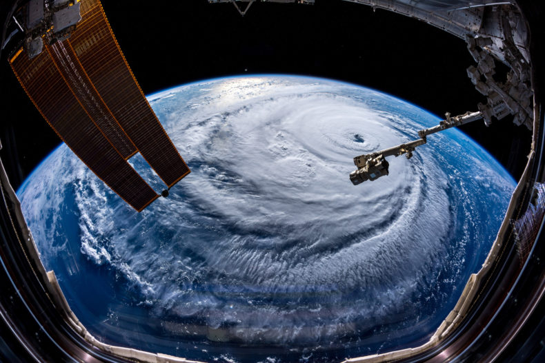
Image credit: Top and gif, USGS Landsat Program; bottom, astronaut Alexander Gerst, from the International Space Station