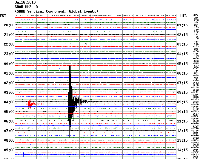
At 5:04 on the morning of July 16, 2010, I woke up because the bed was vibrating, as was the floor. A small rumbling noise moved through the room and on out, and I thought, “earthquake,” and went back to sleep. It turned out to have been a magnitude 3.6 – pretty big for these parts.
Heather, however, lives in the Pacific Northwest, in the Cascadian subduction zone where a little tectonic plate named Juan de Fuca slides under the western edge of the enormous North American plate. Plates don’t slide under other plates without drama, and around 300 years ago, Cascadia had what was probably a magnitude 9 earthquake; the magnitude scale tops out at 10.

Cascadia has had lots of non-negligible earthquakes since, so geologists pay attention and most recently, have sunk an array of earthquake sensors in the ground above the subducting plate’s leading edge. Along that edge, swarms of small tremors happen, hardly noticeable, but geologists think that understanding those tremors might help predict big earthquakes.

The reason they think that is, while the plate’s leading edge is pushing under North America, the part of the plate farther that’s back, under the Pacific ocean, is stuck, locked in place; and sometime in the next century it should come unstuck and trigger another huge earthquake. So geologists are watching for those little seismic events — they look like the little cardiac events before the big one.
I, luckily, live in Baltimore which is right smack in the middle of the large, stable North American plate that runs to the middle of the Atlantic — and is immune to such cataclysmic goings-on. Except when it’s not.
One of the largest earthquakes in this country – and that includes California – happened in 1812 in New Madrid, Missouri. It was actually three earthquakes, magnitudes 6 to 7.7; the Mississippi River seemed to run backward, whole islands disappeared, the earthquakes were felt on the east coast.

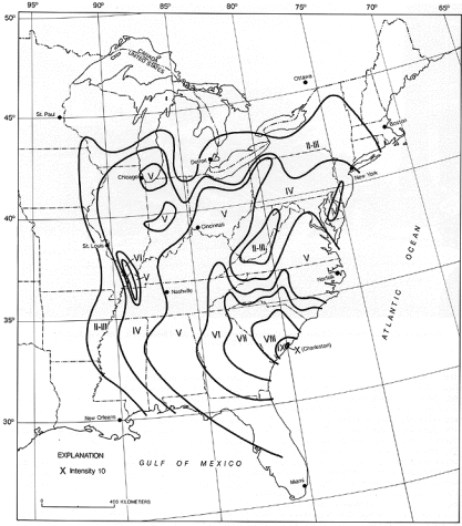
The other largest earthquake in the country happened in 1886 in Charleston, South Carolina. It was magnitude 7.3, damaged most of Charleston and killed 60 people, and was felt in New Madrid, Milwaukee, Boston, Cuba and Bermuda. These so-called mid-plate quakes travel so well because the mid-plate’s bed rock is cold, fairly solid, and rings like a bell.
Mid-plate quakes are also a little mysterious. The faults out here are deeply buried, rarely and erratically active, and unreliably mapped; and geologists can’t usually pin any given small, Baltimore-type earthquake to any particular fault. Earthquakes along the plate’s edges, like the Cascadia quakes, are reasonably well-understood and hand-wavingly predictable, says the U.S. Geological Survey, but the mid-plate quakes are not. The USGS adds, not reassuringly, that the problem is still being studied a century later. A not-understood earthquake is an unpredictable earthquake — the estimates on recurrences of New Madrid and Charleston are 1 to 500 to 1000 years. And given the mid-plate’s potential, I remain unreassured.
Photo credits:
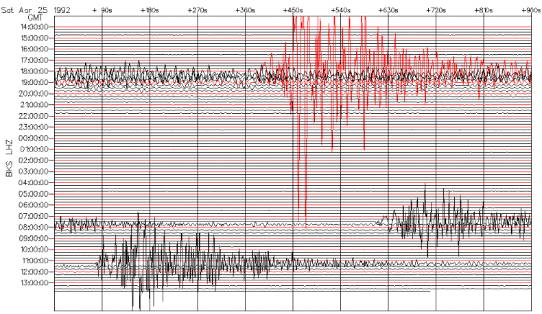
seismograms: Maryland Geological Survey, Berkeley Digital Seismic Network, Natural Resources Canada
Mercalli map: U.S. Geological Survey
I only knowingly lived through one earthquake, in Italy in 1968, when the ceiling light rattled in Modena and I later learned that there’d been a substantial quake 200 miles to the south. You guys must be trembling in your shoes all the time!
Just out of curiosity, how did they measure the magnitude of those quakes in 1812 and 1886, given that Richter wasn’t even born until 1900?
Smarty pants. They use what they call the Mercalli scale, a hierarchy of effects that people felt: did things rattle, did they fall off shelves, did furniture slide around, did heavy appliances fall over, did the chimney fall over? did the walls fall down? Then they map the responses to see where the effects were strongest. The Charleston map above is a Mercalli map. They can covert Mercalli numbers to Richter numbers. You can tell the difference because Mercalli’s are in Roman numerals and Richter’s are in regular numbers.
Curiosity satisfied, thanks!