When Alson Kelen was young, he used to lie at night against his father’s arm, on an island where there were no lights and no cars. He listened to waves slapping against wet sand, the breeze shaking the palm fronds, the delicate crackling of a coconut shell fire. As the purple-blue evening gave way to night, Alson’s father would tell his son to close his eyes. And then he would tell stories—stories about sailing, about flying on the wind, about the triumph of surviving long and difficult journeys.
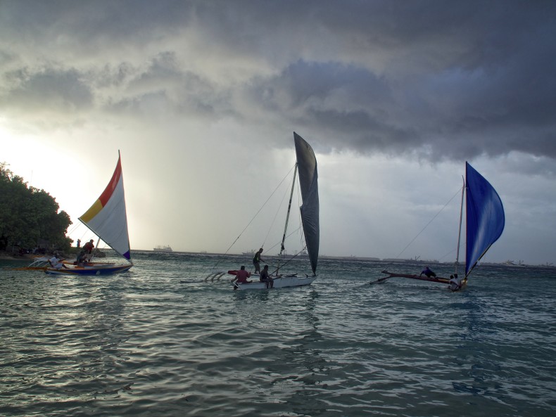
The Marshallese are quite possibly the best voyagers in the world. The Pacific island nation they call home is more than 4,000 kilometers from the nearest continent; a smattering of land scattered over nearly 2 million square kilometers of ocean. Yet even though the Marshall Islands’ elevation averages just two meters above sea level, making it impossible to spot islands from a distance, Marshallese navigators routinely sailed hundreds of kilometers in dugout outrigger canoes, without a speck of land in sight. To navigate, they relied less on stars and more on the ocean itself.
For centuries, scientists ignored this indigenous knowledge, and it was nearly lost. But today, the Marshall Islands’ unique brand of navigation is gaining a foothold in Western science—and helping to launch a cultural revival at the time it’s needed most.
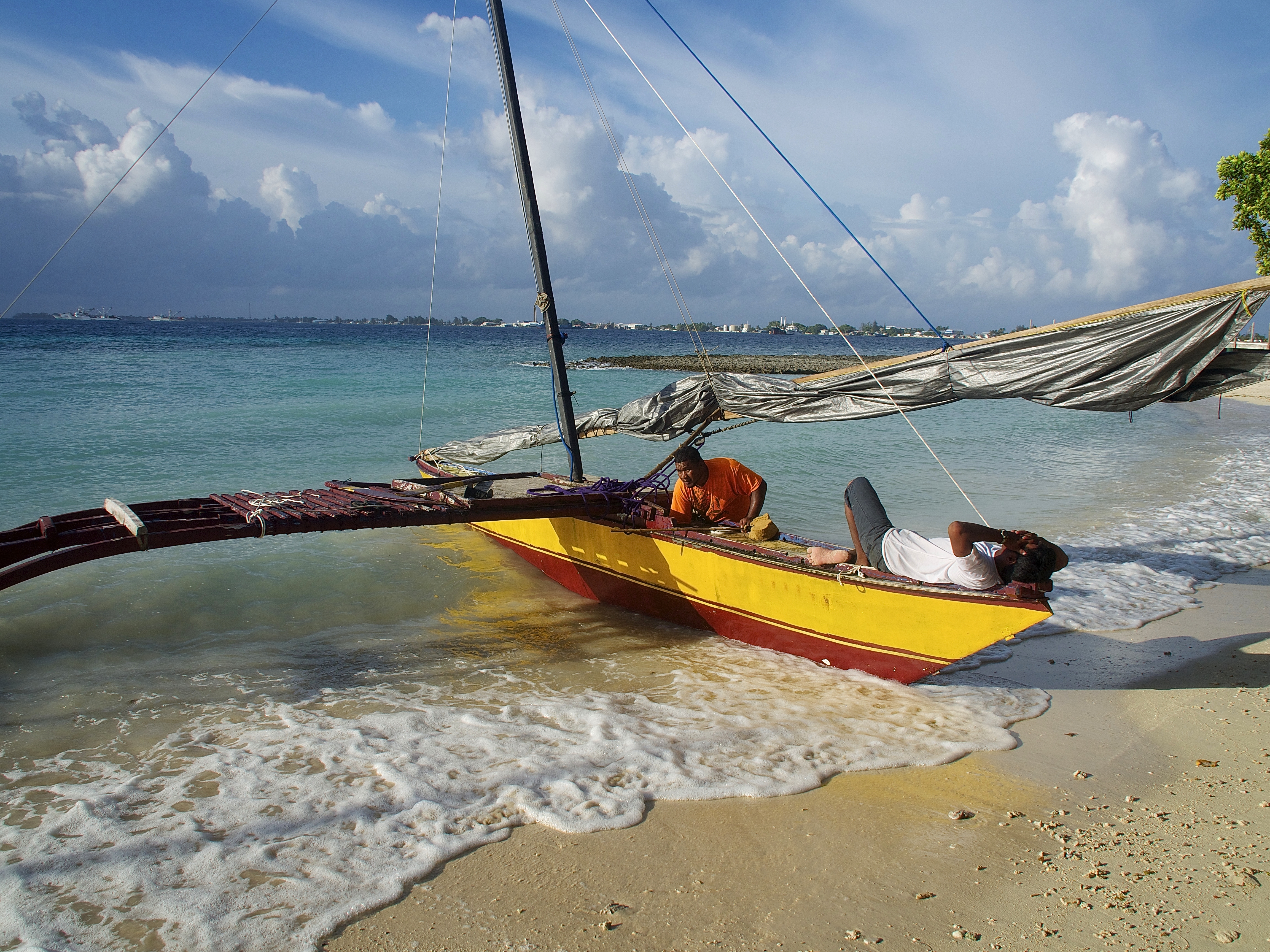
As a child growing up on the remote Marshallese island of Bikini in the 1970s, every family Alson knew had a dugout outrigger canoe, painted in bright colors. He and his friends would climb and play on them, showing off their fathers’ latest work—a new cleat, perhaps, or a fresh paint job. Before Europeans colonized the Marshall Islands in the 19th century, Bikini had been a hub of traditional navigation. There are legends, supported by anthropological study, that canoe-building and navigating techniques pioneered here spread across all of Micronesia. Bikinians knew waves the way Iñupiaq know snow: with a depth born from countless hours of observation, an understanding of place that modern science can barely hope to emulate. The knowledge was passed down through designated navigators, both male and female, and guarded like a family heirloom.
But then the Germans came. And then the Japanese. And eventually, the Americans. Traditional skills were stifled or outright forbidden. Bikini and Rongelap—hubs of Pacific navigation—also became the center of nuclear testing by the United States. From 1946 to 1958, the United States detonated 67 atomic bombs there, forcing entire communities—including Alson’s—into exile.
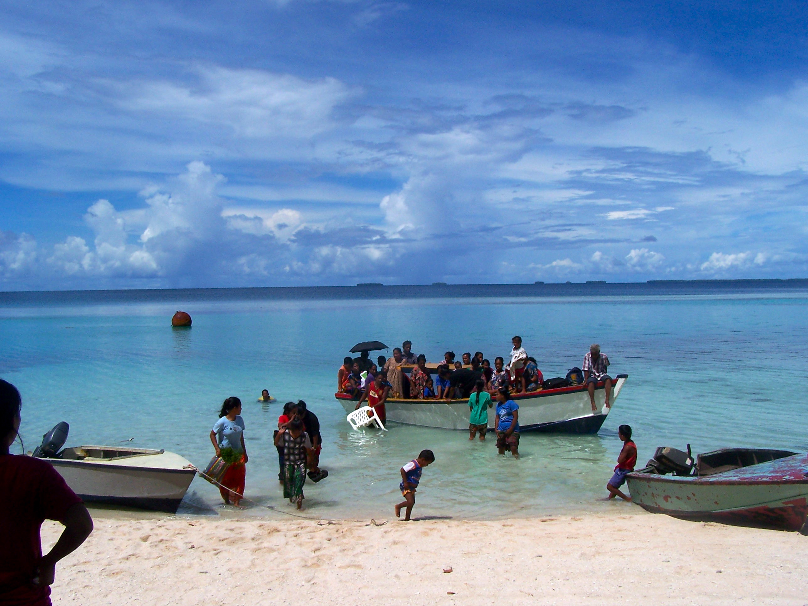
When Alson was growing up in the 1970s, Bikini islanders were briefly allowed to go home, giving Alson a glimpse into a disappearing world where people still traveled mostly by sail. But after several years, the Department of Justice realized the island was still radioactive, and the United States forced Bikinians away from their home for the second time. Most never returned. Alson went to Hawaii for high school and worked as a long-haul trucker in Oregon. In Majuro, the capital of the Marshall Islands, other Bikinians moved into slum-like sprawls. Fishing degraded as beaches were strewn with trash. The knowledge that had been passed down for millennia “was fading away,” Alson says.
So in the early ’90s, Alson partnered with an American boatbuilder and a local museum to document the process of building Marshallese-style canoes. As he worked, teenagers who had failed the country’s high school entrance test hung around the construction site. Slowly, he formed an idea: a program that would teach Marshallese teenagers life and job skills through learning to build and sail outrigger canoes.
Today, 400 teenagers and young adults have graduated from Alson’s six-month program, called Waan Aelõñ in Majel (Canoes of the Marshall Islands). His passion also helped spur a revival of traditional outrigger sailing in other Pacific nations like Yap and Hawai’i. And along the way, it caught the attention of Harvard experimental particle physicist John Huth, Dutch oceanographer Gerbrant van Vledder and University of Hawaii anthropologist Joe Genz. The three scientists are working with Alson and the last of the Marshall Islands’ expert navigators—an elder who calls himself Captain Korent—to help translate ancient navigational techniques into modern scientific terms.
At first, Huth and the other Western scientists had their doubts. Captain Korent described four main ocean swells, for instance, while Western sailors could feel only one or two. Even computerized buoys dropped in the ocean fail to pick up the minute sensations Korent uses to navigate.
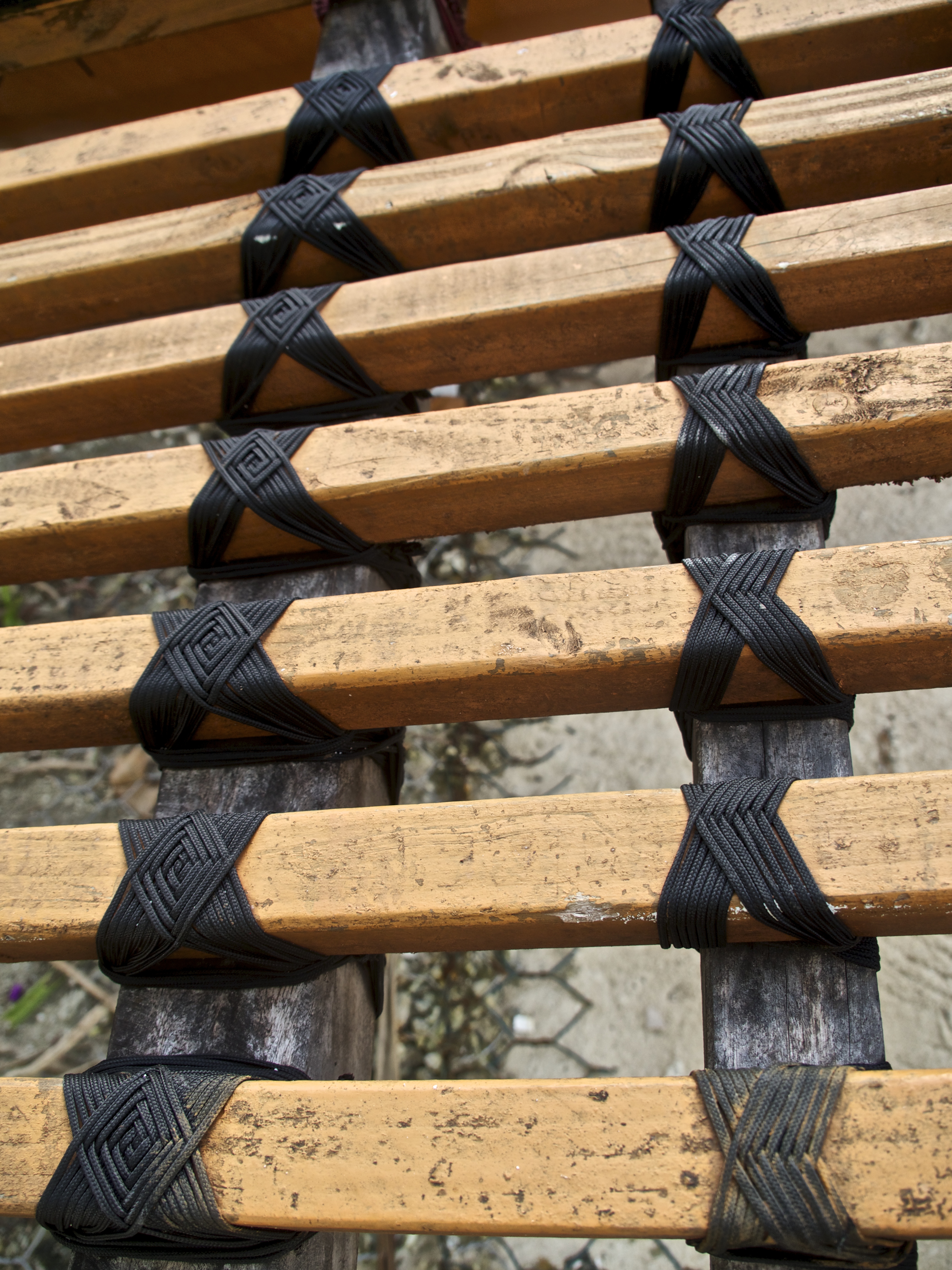
But Captain Korent had learned to feel those sensations the way Marshallese navigators had learned for generations: By floating on his back, memorizing the patterns beneath him. Later, he’d use a stick chart—a cartographic chart made of curved sticks that shows the predominant swells in the region—to place those waves in a larger geography in his mind. If he became disoriented at sea, he could close his eyes and use the feeling of the ocean to determine the direction of land. Anthropologists call this wave piloting. But until now, no one quite understood how it worked.
One technique, for instance, allows a navigator to sail between any two islands in the Marshalls—essentially, any straight line between two points in an area spanning 2 million square kilometers of water—by identifying a ridge of waves, called a dilep, that seems to connect neighboring islands. There’s no doubt that Captain Korent can feel this dilep, but either his attempts to explain it to the scientists fell short, or more likely, the scientists’ attempt to understand what he was explaining fell short.
Undeterred, Huth—who helped discover the Higgs boson and says things like “monochromatic, planar waves [that] represent a superposition of different wave lengths and frequencies”—flew to the Marshall Islands this summer and embarked on a 240-kilometer voyage by outrigger canoe. He wanted to experience something that made no sense to his scientific mind. And as he lay awake in the hull of a boat, looking at the stars and frantically scribbling wind speed and wave dynamics into a salt-sprayed notebook, he felt he was on the verge of translating this ancient knowledge into modern scientific terms for the first time.
This is Captain Korent’s dream, and in a sense it’s Alson’s too. The hope is that if scientists can understand the physics that underlie indigenous wave navigation, someone like Huth could explain it in a way that’s reproducible. He could, in effect, produce a wave-piloting textbook.
In a time when life on the Marshall Islands is seriously threatened by rising sea levels, this knowledge isn’t just a form of cultural revival. For the teenagers graduating from Alson’s program—many of whom will raise their children outside of the Marshall Islands—it represents a physical tether to their place in the world; a sense that they’re voyagers, not victims. If the skills their grandmothers and great-grandmothers hung on to for so long are validated by some of the world’s greatest scientists, perhaps climate change won’t mean cultural genocide. Perhaps the Marshallese will push off into the unknown, as their ancestors did, and thrive.
Krista Langlois is a freelance journalist based in Durango, Colorado. She lived in the Marshall Islands from 2006 to 2007 and returned in 2015 to report a story for Hakai Magazine.
All photos by the author.
One thought on “Guest Post: How to Navigate a Rising Sea”
Comments are closed.