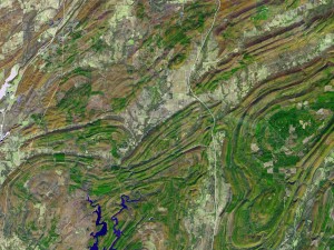
 I swear, you could get a good start at being a practicing geologist, just from looking at maps. These lovely looping patterns are a satellite’s view of some mountains in southeastern Oklahoma. They are the Ouachita, pronounced Wachita and mispronounced Wichita. I’m fond of the Ouachita – they’re sleepers. And given what went on underneath them, we’re probably glad we weren’t around when they were awake.
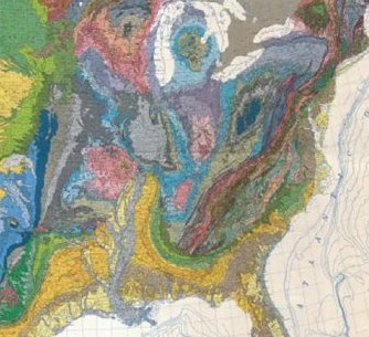
 To figure out the Ouachita, here’s a geologic map, the rocks under the surface. The yellow-y tan is recent mud, washed off the interior of the continent a few 10s of millions of years ago. Just above it is a swoop of green stripes that’s rock around 100 million years old. Above the green stripes, in the east, is a long, braided mess of grays and pinks and blues, running all the way to the top of the map, that are the Appalachian Mountains, and they’re the oldest of all.
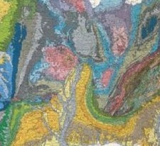
Isn’t it odd, how the yellow intrudes on the green stripes, and how, on the west side of the yellow, the green continues? And how if you look more closely, the gray/pink/blue mess continues too? That western patch of blue/gray is the Ouachita Mountains. So wouldn’t you suspect that the green stripes and the blue/gray messes must have been connected, must be the same thing, that the Ouachita must have been the southern tip of the Appalachians — only something happened?
You’d be right, the Ouachita are secretly the Appalachians. They were a long mountain chain across the supercontinent, Pangaea, and around 200 million years ago, when Pangaea came apart into our usual continents, the mountain chain became the southern edge of North America. In the process of coming apart, the southern boundary tore, ripped up the middle like a sheet; and a rift now separated the Appalachians from the Ouachitas.
 Here’s where I get excited: at the very top of the rift, the Reelfoot, is a swarm of faults and right in the middle of it all is the town of New Madrid, Missouri. In 1812, New Madrid had one of the country’s biggest earthquakes, three earthquakes really, that made the solid rock underlying the country’s eastern half ring like a bell. The shaking was “strong enough to alarm the general population,” says the USGS gravely, “over an area of 2.5 million square kilometers.”
 The Ouachita lie between the Reelfoot rift and another fault in southwestern Oklahoma called the Meers. The Meers is an obvious fault in the ground — most eastern faults are buried and invisible — and may have been part of Pangaea’s rifting. Nevertheless, the Meers is quiet, it’s not famous, has no big earthquakes — though geologists suspect maybe two huge ones thousands of years ago.
I don’t mean that the people of Oklahoma should flee the Ouachita for fear of being surrounded by dreadful earthquakes. I mean only that I like the violence buried under those old, lonely, reticent mountains.
Credits:
Ouachita Mountains, satellite: Jesse Allen & Robert Simmon, NASA/GSFC/METI/ERSDAC/JAROS, U.S./Japan ASTER Science Team
geologic maps: U.S. Geological Survey
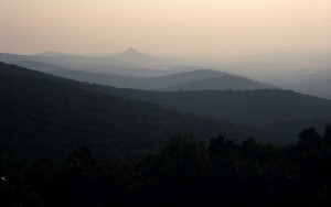
Ouachita Mountains, photo: dismalhiker
Presumably the maps were drawn by a Ouachita Lineman? (Sorry)
Tim, you’re very bad. On a separate issue: should that satellite picture of the mountains have been bigger? I’m obsessed with the visuals these days.
Not a problem, you just click it and it gets bigger.